


HELVELLYN WALKING ROUTE
Quick facts
DURATION
4-5 hours
DISTANCE
6-12 miles
EXPERIENCE LEVEL
All levels
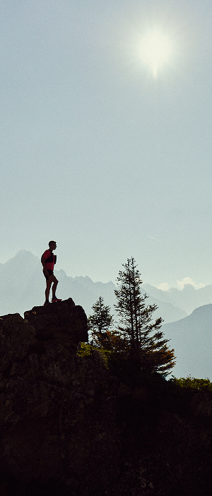
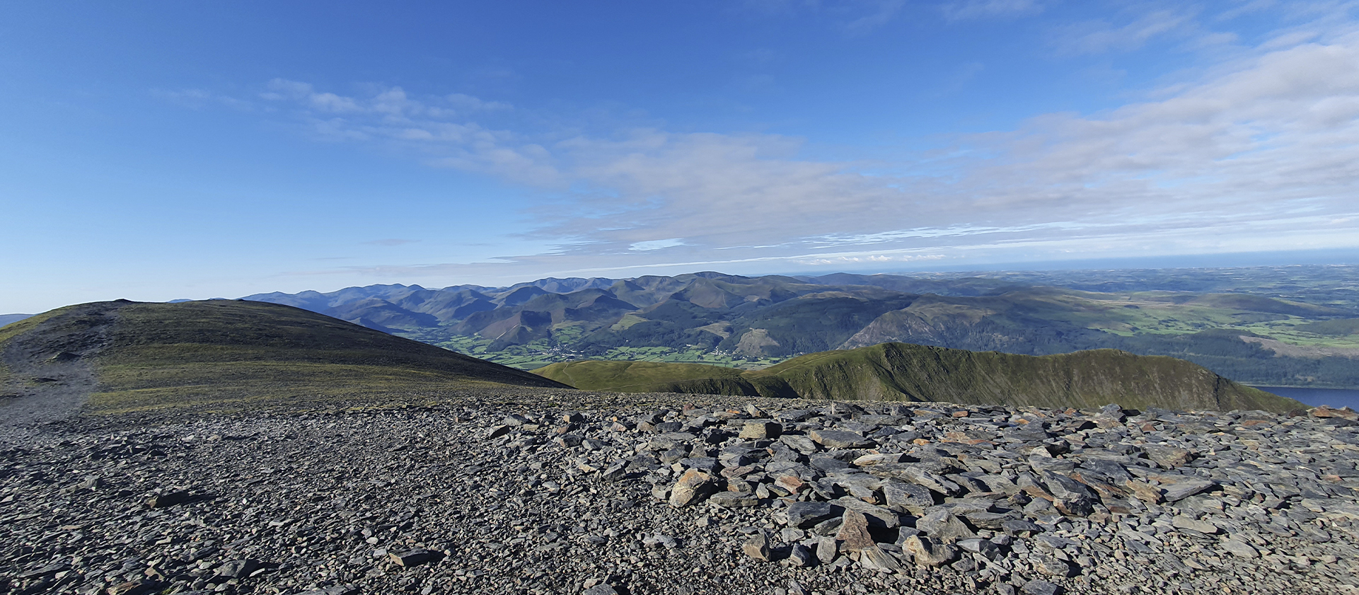
Being the third-highest peak in both England and The Lake District Helvellyn is a staple piece and is one of the must-visits for hikers and trail runners when visiting the area. Helvellyn boasts a spectacular glacial cove holding a body of water called Red Tarn. Either side of the tarn is two sharp, dramatic ridged edges, Swirral, and Striding edge. Being able to maneuver these edges allows reaching the broad plateau of a summit where you are able to capture views of Thirlmere, Ullswater, and the other Eastern Fells.
HIKING/TRAIL RUNNING ROUTE FROM GLENRIDDING
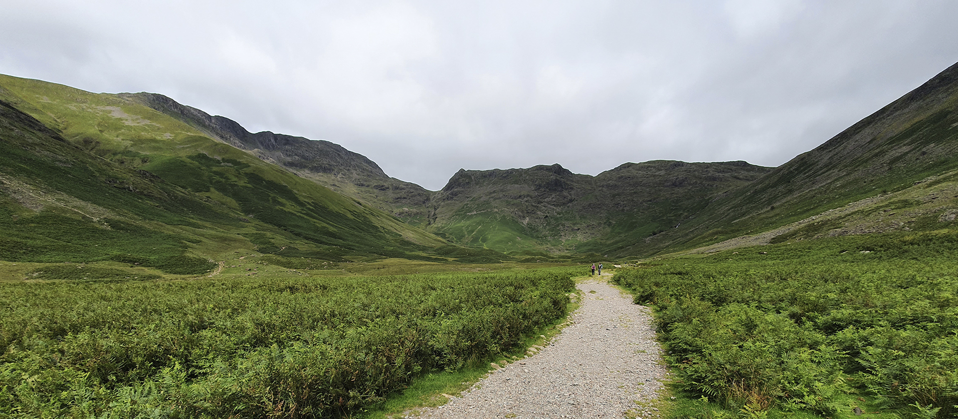
There are a number of ways you can summit the spectacular Helvellyn. However, starting from Glenridding allows you to take one of the dramatic edges. Parking can be found all around Ullswater and Glenridding with a number of pay and display car parks dotted around the villages. Once parked you want to head up the valley towards the Gillside Camping and Caravan park past the Travelers rest pub....
The path to head up Helvellyn is the left fork in the road and passes over a bridge and starts to climb. As you move along the path there will be a further fork following signs for Helvellyn via Miresbeck. After around 100m along this path, you should reach a hole in a wall where you should turn right onto a broad and obvious path continuing to another wall where you should stay right and continue upwards.
Following this path will bring you to a gate which you should pass through and turn instantly left. Following this, you will reach a small stream known as Mires Beck which you should follow uphill. Following this stream brings you to it's head where the path curves right with a wall on your left. As you continue and crest the hill you have been climbing you will see Striding Edge on your left and Swirral Edge on your right.
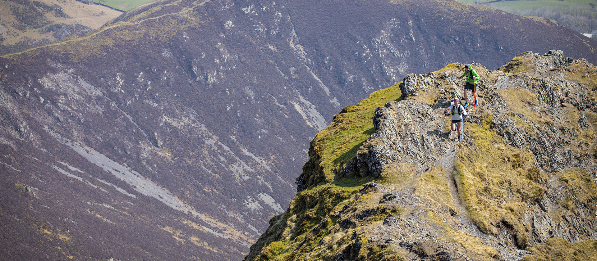
STRIDING EDGE
If you are a bit of a thrill-seeker and like a small amount of scrambling then Striding Edge offers this kind of adrenaline rush. You will be able to spot the path onto Striding edge snaking up the left-hand side of the valley. If you find yourself hiking up this side of the valley and decide you do not want to reverse the edge then look for a path on your right-hand side that is still exposed but avoids the edge. Move along the edge where it is obvious where you are heading. However, at the end of the ridge, there is a part where you have to scramble down before making the final ascent where you will need to climb with your hands and making sure to bear right at the top to hit the summit.
SWIRRAL EDGE
Once reaching the "Hole-in-the-wall" there is the option to summit via Swirral Edge. You simply follow a path on your right that takes you down towards Red Tarn where you need to pass over a small footbridge before you start climbing again. This climb is a lot short than that of Striding Edge but is much steeper, with a Grade 1 scramble, best suited for a summer summiting. Once making this climb it's an easy run into the summit.
When descending it's best to return via Swiral Edge and Catsycam as it is a lot less challenging and is a much more relaxing finish.
Read more ⌄
HIKING/TRAIL RUNNING ROUTE FROM THIRLMERE
One of the Car Parks located along the shore of Thirlmere is Swirls Car Park with is found at the north end of the water. From this car park you head over a small footbridge and bear right through a wooden gate. As you progress follow the signposts for Helvellyn. The path remains stoned and obvious passing through another wooden gate before the big climb begins....
You will continue to climb up the hillside following the stone path. There are areas that become steeper and may require some scrambling with some additional areas of loose rocks and scree. Following this path, you will meet a junction where you need t keep to the right, and the path with bringing you around towards the summit.
When descending it's advised to come down the same way you ascended. Making sure to take a left at the junction to make your descent. But is possible to carry along the tops to Nethermost pike then descending back towards the road and following the forest track back to the car park.
Read more ⌄
HIKING/TRAIL RUNNING ROUTE FROM WHYTHBURN
An additional route of ascending Helvellyn is by parking in a smaller car park just 5 minutes north of Whythburn on the East side of the water. From the car park, you pass through a forest until you reach a forest path. Pas straight over this path and continue moving uphill....
The path continues uphill being obvious and Stoney. The climb remains steep and unforgiving as you move around Comb Crag and pass under Nethermost pike where the gradient gentles before you make your last climb towards the summit.
When descending you can either come back the same way making sure you take the path to your right before it starts to climb up to Nethermost pike or passing over the summit and descending via Swirls Car park and coming along the forest track back to where you started
Read more ⌄
Similar Routes to Hevellyn
ADDITIONAL INFORMATION
Caution should be taken at all times when running or hiking in the Lake District fells. Only undertake a route if you are adequately prepared and fully equipped for the conditions you might face, ensuring to carry all emergency equipment. Headtorch with spare batteries, a full set of waterproofs, emergency blankets, and whistle. Please also ensure you are confident in the use of a map and compass.
Check mountain weather forecasts before setting off (the weather can change very quickly in the fells, especially higher up) and always let someone else know the route you are planning to take.
Stay on the designated paths, respect the countryside, leave gates as you find them, take all your litter home, and no leave nothing but footprints.
For more advice on safety in the Lake District fells we thoroughly recommend you read these two pages by Mountain Rescue and Lake District National Park.
Kit advice: The highest peaks in England are prone to unpredictable and inhospitable weather, so for this walk, we recommend the Thermoshell Pro Insulated Jacket for extra warmth if the temperate plummets and the Stormshell Waterproof Jacket for maximum waterproofing.